A walk of four bridges
The site is managed by Shropshire Wildlife Trust (their first reserve in Shropshire acquired by them in 1964) and The Friends of Pontesford and Earls Hill. The twin outlines of the hills are often seen as a sleeping dragon and are made up of volcanic rocks that were formed nearly 600 million years ago. The acidic nature of the rocks helps acid grassland flora flourish on the tops of the hill.and are designated as an SSSI.
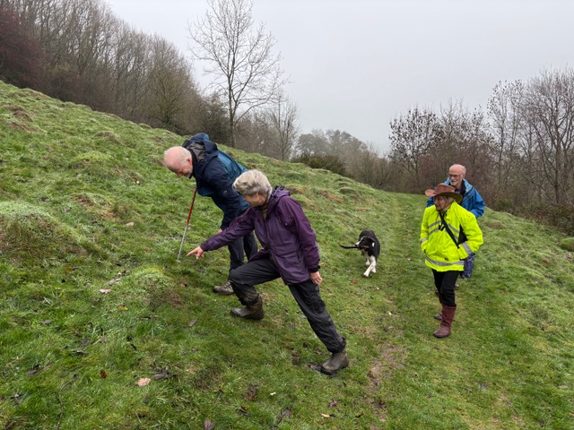
Our intrepid group set off from Pontesford Hill carpark Not for us the climb to the summit, a day of hanging veils of mist clinging to the tree tops and hillsides after the downpours of storm Claudia the previous day greeted us, making for a gloomy aspect, we were not to be put off! Walking along the base of the hill we eventually came to one of the two SSSI’s sites of the reserve that make the area so varied, the ant hill meadows. As we were in the depths of winter the mounds created by industrious Yellow Hill Ants were prominent amongst the wintery short grass. Not an ant to be seen! However this part of the hill is followed by a walk along the bottom of an interesting area of scree which has weathered from the cliffs of volcanic rocks above. We stopped to examine some of the Rhyolite rocks which are some of the oldest in Shropshire.
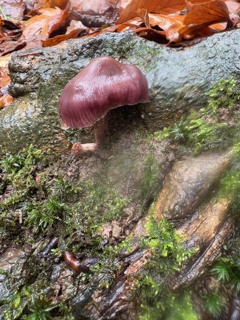
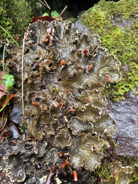
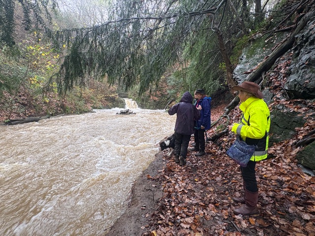
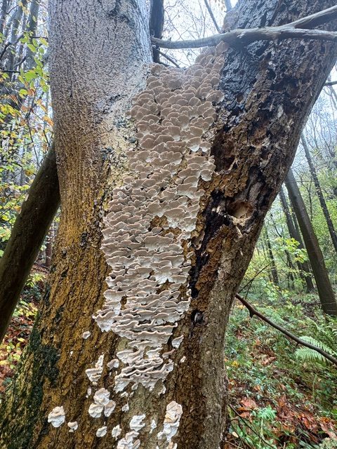
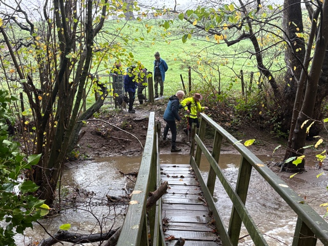
The damp weather had made some of the lichens on the rocks look plumped up and vibrant, most notably Membraneous Felt lLchen (Peltigera membranacea). In the woods along the base of the scree we examined several fungi such as Variable Oystering (Crepidotus variabilis),Hairy Curtain Crust (Stereum hirsutum) and Burgundydrop Bonnet (Mycena haematopus) . Some of the trees had huge patches of Turkey Tail (Trametes versicolr) clothing their trunks. Continuing on past the scree we descended down towards the Habberley Brook Now in full spate after the rain, number one of the four bridges had to be tackled Would we manage the first one? The brook had swallowed up some of the area before the foot bridge, but the lure of Oaks Wood looked too tempting, we helped each other over the flooded footpath, onto the bridge and into the wood.
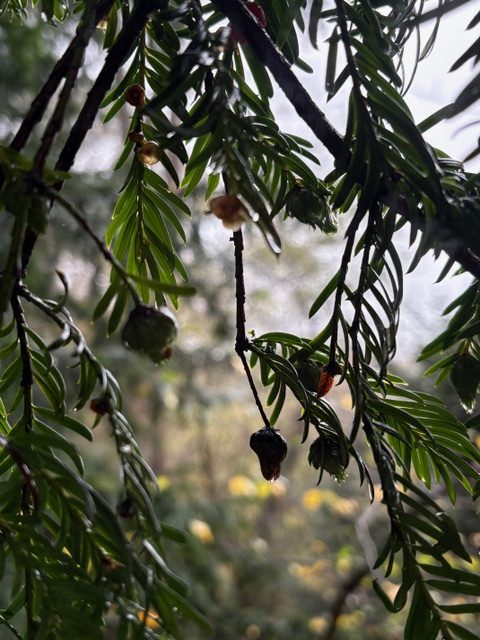
The Brook follows a fault called the Pontesford Linley Fault, an ancient shoreline which separated land to the East and a deep ocean to the West in the Ordovician period 480 million years ago. A time when there was a huge surge in marine diversity.. Onwards into Oaks Wood ,which seemed like a rainforest. The damp air made bird song more noticeable and we soon heard some Marsh Tits. Evidence of the high rainfall from the storm could be seen not only in the volume of water in the brook but also by a waterfall tumbling down the side of the “gorge” that the Habberley Brook flows thorough, before emerging in the village of Pontesford. At our last bridge an ancient Yew tree can be seen hanging off the steep side of the valley, its roots entwined with the rocks. Its branches were hung with many galls formed by Yew Gall Midge. We were seeing the second year of the midge’s lifecycle when the buds of the yew tree become swollen after which the midges will emerge as adults in Spring. Despite all the intrepid crossing of bridges we decided to continue down to the Lyd Hole waterfall to see the Habberley Brook roaring over the falls; a favourite spot with local author Mary Webb. After this we returned to the car park feeling as if we had had a proper adventure into the wilderness.