About
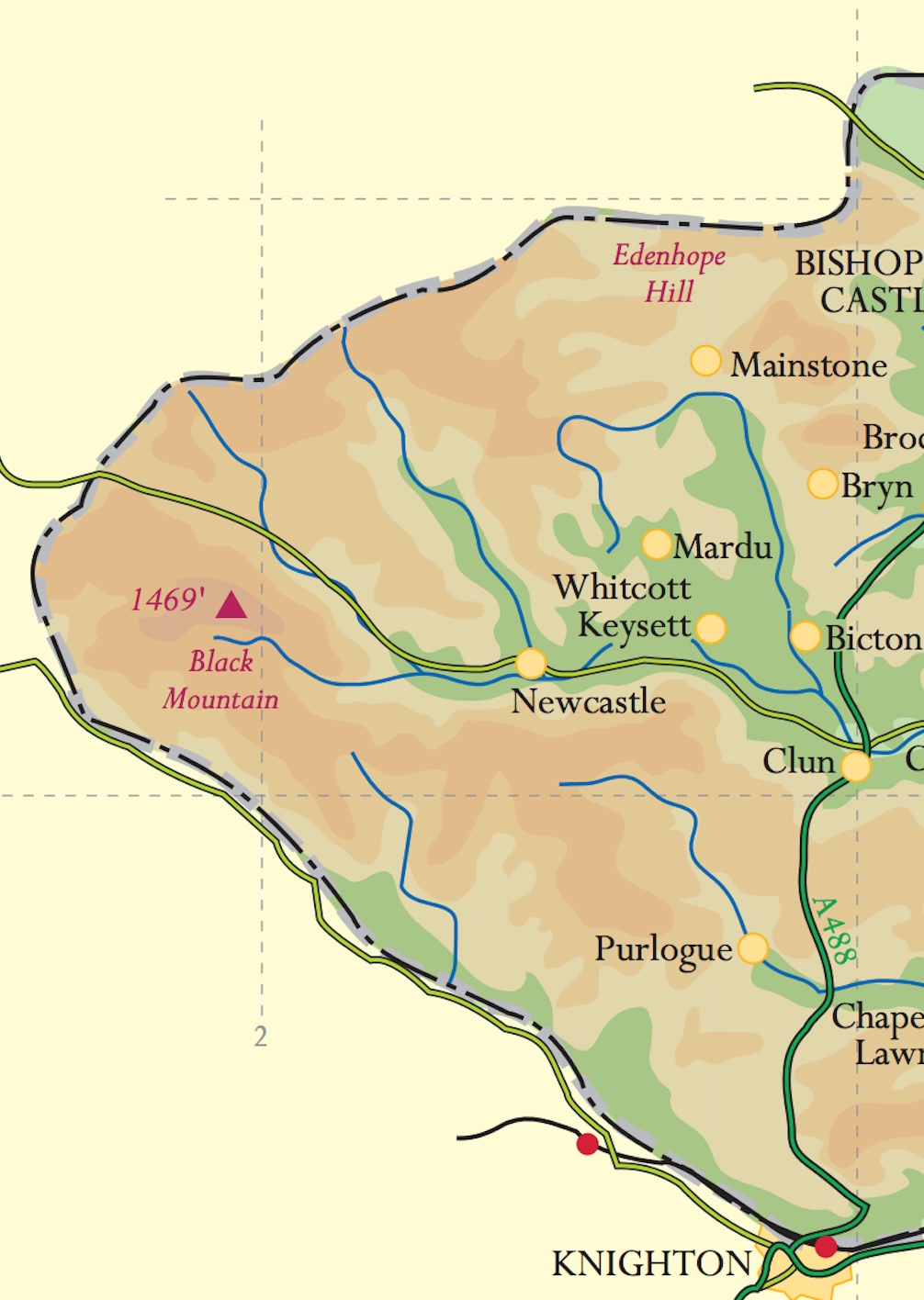
The catchment area of the Upper Clun is underlain by rocks of Silurian age, which 420 million years ago were deposited as sandy silts and muds, eroded from the surrounding land, into a marine basin. These sediments consolidated to give rise to red and grey shales, mudstones and siltstones (the Clun Forest and Cefn Einion formations respectively). The rocks are relatively weak and the hills have a characteristically steep-sided, shallow-domed shape with few outcrops. We can only see them in rare exposures or more easily (for the Cefn Einion siltstones) in the walls of the older buildings in Newcastle, Clun and the surrounding hills. To see a detailed geological map use the British Geological Survey’s viewer at BGS Map App.
A free-draining acid brown soil has formed over the siltstones, which would have supported moorland and rough grazing in the pre-Roman era. Today the land is mostly grazed, although arable production is possible in some areas. Alluvial silts and glacial clays are somewhat richer but these are confined to the river valleys and dingles.
The area falls into Natural England’s Character Area 98 – ‘Clun and North West Herefordshire Hills’ – of which the key characteristics are described as:
- Rolling, rounded upland hills divided by narrow valleys widening to the east.
- Uniform landforms, similar to mid-Wales and contrasting with the rest of the Welsh Marches.
- Small, wooded, enclosed upper valleys broadening to flat-bottomed intensively-farmed lower valleys.
- Irregular field patterns in valleys and around settlements contrasting with large rectilinear fields on higher ground.
- Large, recent conifer plantations, contrasting with remnant, ancient, semi-natural woodland.
To the west our area merges into the high moorland of Powys while further east the landscape becomes more domesticated. Hedges reach up to enclose most hill tops although patches of heathland and unenclosed upland grassland remain. On the ridge tops, the hedges are generally low with occasional trees in the more sheltered hollows. The unimproved pasture is sometimes in a patchwork with the smooth greens of improved grassland and occasional patches of arable land. There are panoramic views, which emphasise the area’s plateau origin, as well as long views down narrow, twisting valleys which widen eastwards.
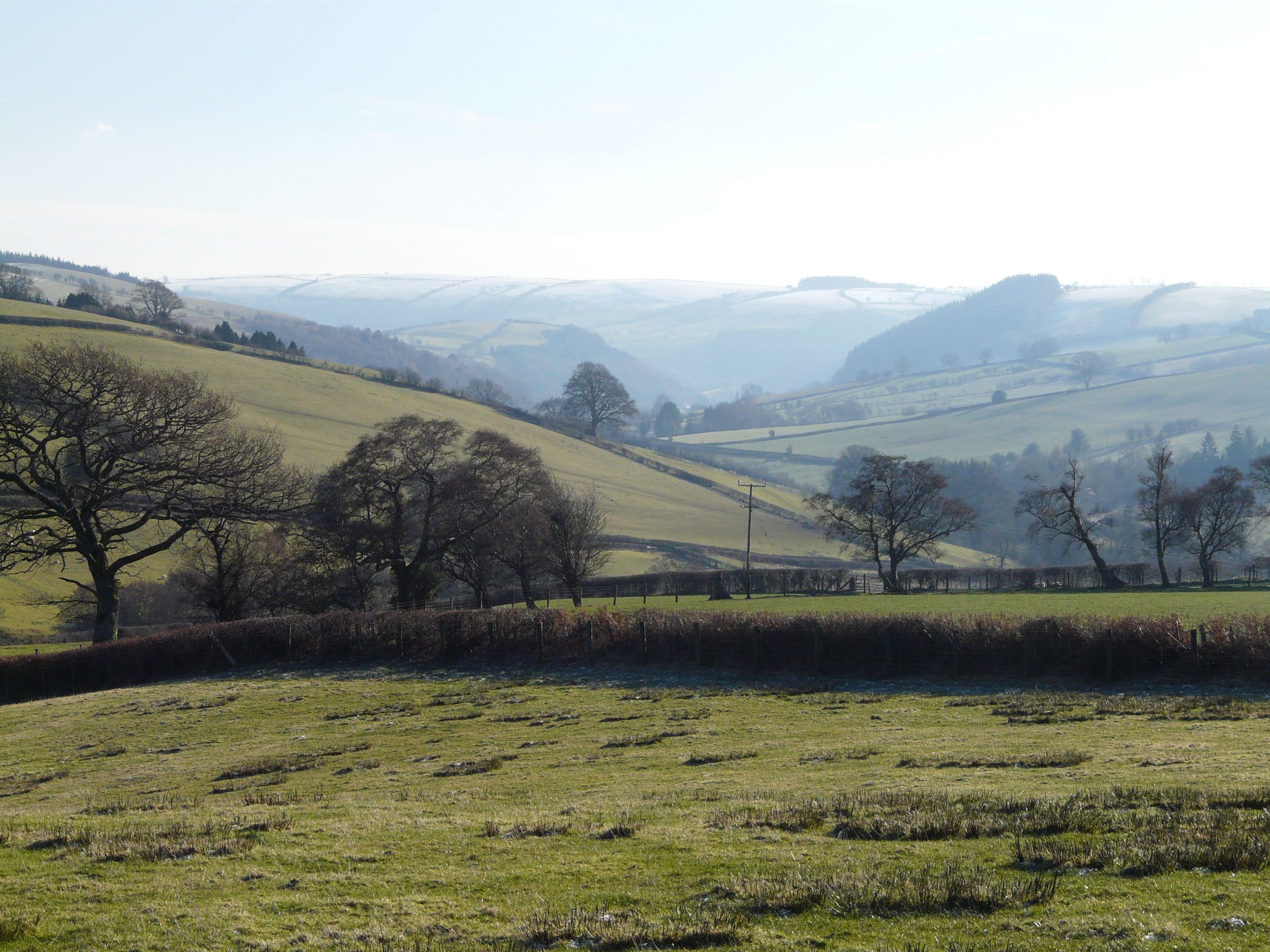
The heads of the tributary valleys are narrow and deeply incised with woodland on the steepest slopes. Down-valley they widen to a narrow floodplain, widening at the confluence of the Folly Brook with the Clun, at Newcastle. On the lower slopes, there is a generally regular pattern of large fields cut through by small streams, often with drifts of streamside woodland. Around the farmsteads, and hamlets the field pattern becomes denser and more irregular. In the Clun valley itself, hedges are lower and intermittent and trees more infrequent.
A changed habitat?
Hedgerows vary in density and management. In some of the upland areas gaps have been renewed or replaced with post and wire. On the floodplains also they are locally intermittent and sparse, with few hedgerow trees.
The improvement of pasture and some arable cropping onto higher ground has changed the historic pattern of cultivation in the valley bottoms and rough pasture on the hills. The deciduous woodlands can be adversely affected by grazing, thus reducing their capacity for natural regeneration and their nature-conservation interest.
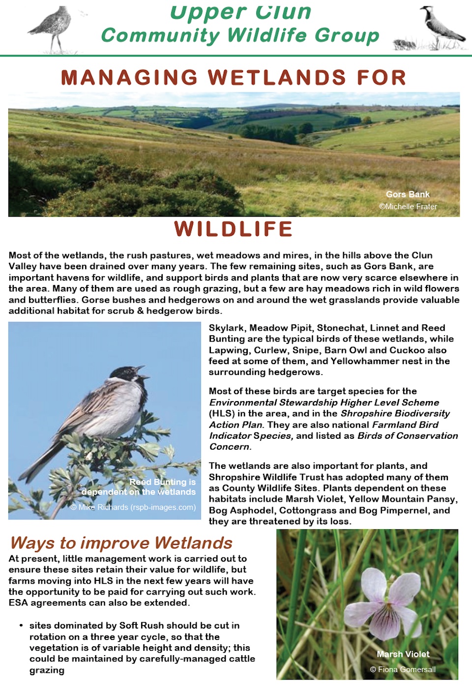
Along stream banks, grazing can be detrimental and pollard management is poor. Riverside alders are suffering from fungal disease and are not being replaced at the rate of die-back. Agricultural land use is likely to be affecting water quality through soil erosion and sediment deposition, together with nutrient losses. The streams are also flashier, running faster in winter and suffering from low flows at times of low rainfall, because water is not retained in the landscape as much as it was – land has been drained, and peaty/boggy areas improved for grazing. See this leaflet for information on managing wetlands for wildlife – Managing wetlands for wildlife.
Some of the coniferous woodlands are nearing the end of their first cycle. There is an opportunity for improving the landscape and amenity value of the woodland, with an increase in broadleaf woodland where appropriate, particularly along the riparian corridor.